environmental SCIENTIST | Issues for the marine environment | October 2018
Earth is a restless planet, constantly renewing its surface by one or another geological or hydrological process, with the added impacts of human activities. Volcanism is one of the most dramatic forms of natural activity, rapidly changing landscapes and impacting local and global environmental conditions. Although we see many of Earth’s most active volcanoes in places such as Hawaii, Iceland, Italy and Japan, by far the greatest number of volcanoes on Earth is under the sea, most being under many kilometres of water. This great depth makes active submarine volcanoes difficult to discover and to observe. But humans are up for the challenge, and like space explorers going to other worlds, oceanographers and marine geologists have been devising evermore innovative ways to study submarine volcanoes, with dramatic improvements in the last two decades or so.
Submarine volcanologists distinguish volcanoes occurring in the deep ocean (deeper than 500–1000 m) from those in the shallow seas, because the effects of hydrostatic pressure dramatically change the style of volcanism with increasing depth and the tools needed to study them. Shallow submarine volcanoes generally erupt near land (e.g. Surtsey, off the coast of Iceland) and often the eruption is visible at and above the sea surface. Deep eruptions, on the other hand, cannot usually be detected from the surface and occur further from land, requiring specialised tools to detect and respond to them. This article focuses on deep eruptions, which are more difficult to detect and study.
The methods submarine volcanologists use include in-situ observations by human-occupied submersibles, robotic remotely operated vehicles (ROVs; some with direct human intervention and some running pre-programmed missions), photography, water sampling by surface ships, satellite observations, and remote monitoring by hydrophone listening stations. All of these are reliant on computers, modern methods of navigation and geo-location (e.g. GPS) and basic geological, geophysical, ecological and/or environmental knowhow. In addition, just like other environments, submarine volcanoes are studied by scientists from many different disciplines, from microbiologists and macrofauna ecologists, to hydrothermal vent fluid chemists, mineralogists, geophysicists, structural geologists, physical oceanographers and volcanologists. The range of studies includes active eruptions, steady-state non-eruptive venting of fluids and ecosystem support, ore prospecting and geological hazards (e.g. earthquakes, tsunami generation, landslides).
History
The latter part of the 19th century brought many scientific and technological innovations. Two of these (the first true oceanographic expedition, on the HMS Challenger, and the laying of the first trans-Atlantic telegraph cables) recovered volcanic rocks from a structure we would later call the mid-Atlantic Ridge, and started the study of submarine volcanoes. It was not until after World War II that modern oceanography really started, in part because of the advent of sonar mapping (echo sounding), which made it much easier to determine seabed depth and the shapes of submarine landforms. This was when the extent of the global mid-ocean ridge system (now known to be more than 60,000 km long) was first discovered and the vast number (many thousands) of mid-plate seamounts revealed. Nearly all of the seamounts are volcanoes.
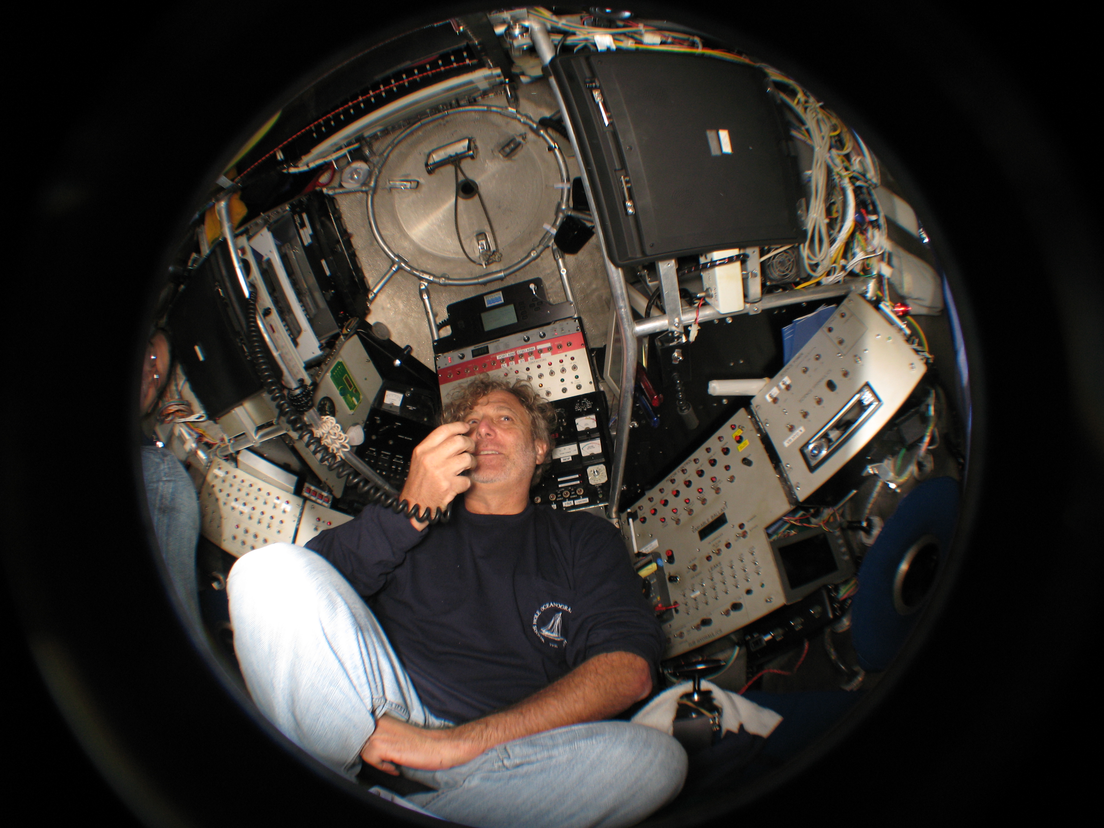
With the advent of human-occupied vehicle (HOV) missions in the 1970s came the discovery of submarine hydrothermal systems, first as low-temperature vents on the Galapagos Spreading Centre, followed by high-temperature ‘black smoker’ vents on the northern East Pacific Rise a couple of years later. These discoveries opened the door to simultaneous geological, ecological and geochemical studies, each needing the development of specialised instruments and tools to measure environmental parameters and take samples in ways that preserved their integrity. HOVs are not for the faint of heart. In addition to the limited driving speed and bottom time (due to battery life and life-support limitations), they are generally small (most outfitted for deep-sea exploration are 2 m spheres), cramped and uncomfortable, with two or three people aboard and no toilet. They bob up and down in the currents during deployment and recovery in ways that make many passengers ill. Yet HOVs still provide the maximum manoeuvrability in an immersive situation, and are by far the author’s preferred means of exploring and working on the deep seafloor.
 The advent of multi-beam echo sounders for seabed mapping and hydroacoustic listening stations in the 1980s gave scientists the ability to locate and map active volcanoes in greater detail. Both of these types of instrument had been in naval use for quite some time before they were approved for civilian use, but once accessible, the numbers of scientists studying submarine volcanoes and participating countries increased dramatically.
Three more military technologies came to the scientific community in the 1990s and transformed the study of submarine volcanoes:
- The global positioning system (GPS) of satellites;
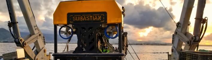
- Remotely operated vehicles (ROVs), which are operated by pilots from a surface ship to remotely control the cameras, lights and sampling tools of a robotic vehicle on the seabed; and
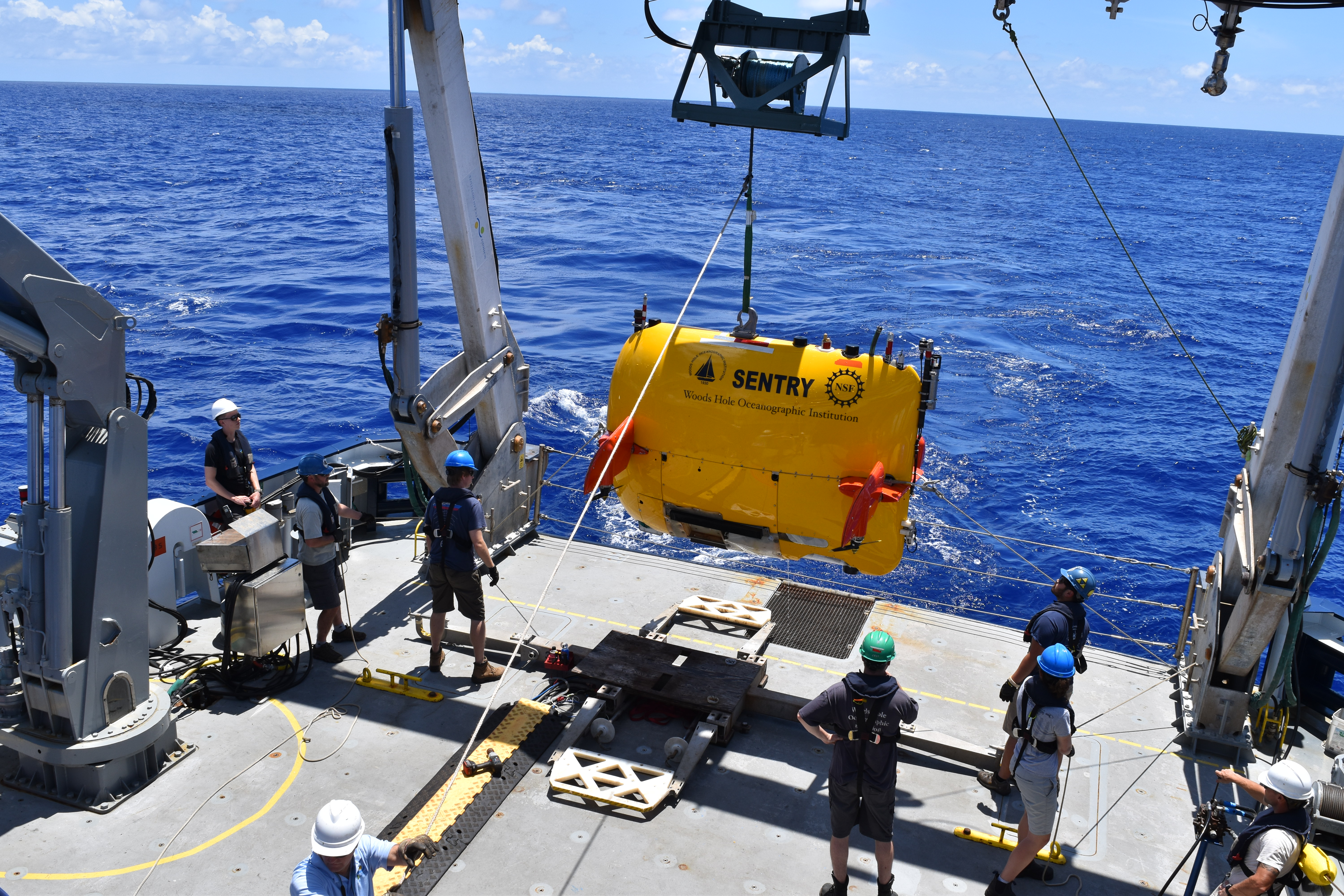
- Autonomous underwater vehicles (AUVs), which are pre-programmed autonomous robots that run subsea mapping and sampling missions and then return to the sea surface for collection.
In addition, the application of transponder navigation (networks of stationary sound beacons) allowed scientists to precisely locate and revisit small features on the seafloor, so that they could begin to make time-series measurements and ecological transects.
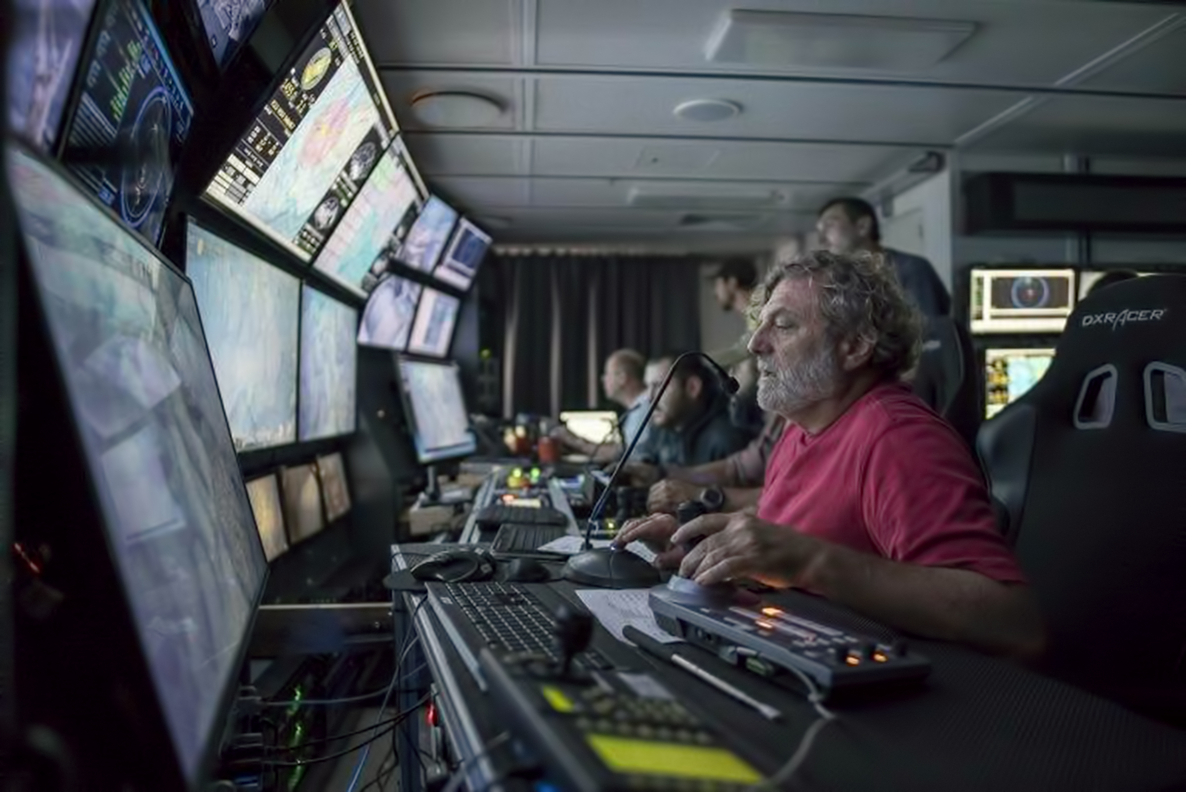
By the 2000s, most of the primary technologies used to study deep-sea volcanoes had been established, setting up a period of improvements in payload, manoeuvrability, power consumption, and the addition of highly specialised sampling tools. The transition from analogue to digital photography and video, and the subsequent increase of resolution, along with new forms of LED lighting systems made possible the documentation of seabed features for repeat viewing, paving the way for the current situation, which is that most seabed studies are conducted by ROV. Live tele-presence (streaming video, commentary and vehicle navigation data) has democratised this type of science, to the extent that tele-presence-enabled operators such as the NOAA Office of Ocean Exploration and Research, the Ocean Exploration Trust and Schmidt Ocean Institute (to name a few) can bring seabed science to many tens of scientists and thousands of public participants around the world in real time.
Modern Methods
The specialised methods for studying the deep-sea volcanic environment include all the standard environmental tools for compositional analysis, genomics, mapping and GIS. However, the deep sea presents unique challenges in terms of sampling technologies, in-situ sensors, real-time monitoring and rapid response for capturing transient signals after an eruption. Only a very few sites on the seafloor are monitored in real time. The best monitored and observed submarine volcano is called Axial; it sits on the Juan de Fuca ridge off the western coast of the USA. It erupted in 1998, 2011 and 2015, and the last eruption occurred while the submarine observatory was coming online, demonstrating the utility of this real-time monitoring capability with earthquake locations, seabed depth changes and water temperature measurements.
The following methods or environments are given as examples of those that have specialised tools used to map and sample deep-sea volcanoes.
Repeat sonar mapping
Repeat mapping by surface ships and AUVs in a tightly constrained geospatial context allows detection of seabed depth changes of tens of metres and decimetres, respectively. AUVs achieve higher depth resolution by using higher-frequency sonar and by flying closer to the seabed than surface ships, avoiding a lot of the sonar noise and sound velocity aberrations of the shallow ocean, but they cover much less ground because of vehicle speed limitations to achieve the best-quality data. Such methods have been used at active volcanoes to identify new eruption deposits and then map their volume and aerial extents. For instance, in one of the author’s study areas in Tonga, as many as 10 new eruption deposits over the last 15 years or so have been discovered by this method at just one small volcano known as West Mata, including one detected in December 2017 that had occurred within the preceding 18 months. Repeat decimetre-resolution AUV sonar mapping before and after the 2011 and 2015 eruptions allowed unprecedented views of lava distribution systems.
Plume mapping
Submarine volcano-hosted hydrothermal systems produce plumes of persistently venting fluids and particles over submarine volcanoes, and eruptions produce transient plumes that are larger and shorter lived. These are mapped using computer-controlled towed packages of CTD (conductivity, temperature and depth) and nephelometry (light scattering) on a sampling rosette fitted with computer-triggered bottles to take water samples for analysis on the ship.
Biotransects
Just as on land, biologists will place markers at sites of interest and use repeat visits to study benthic community composition, structure and stability in relation to possible changes in chemosynthetic energy sources from diffuse- and focused-flow hydrothermal venting. They also deploy colonisation experiments (e.g. preformed blocks of rock) to examine settling and recruitment of microbes and macrofauna larvae.
Water sampling
Tools to sample hot hydrothermal fluids and to preserve their integrity include titanium samplers fitted with valves, a long sampling tube and devices to draw in the hot fluids (up to 400 °C) activated by a submersible manipulator (robotic arm). Other similar devices are used to sample fluids for gas analysis, a key parameter in volcanology. These devices maintain the sample at in-situ pressure during the trip back to the sea surface and are chemically inert to keep fluid compositions intact. Some in-situ sampling devices can take multiple samples at once, and even carry out radioactive labelling experiments for in-situ metabolic or bioactivity analysis.
Rock and sediment sampling
Volcanic rocks hold many keys to unravelling volcanic eruption styles and durations, as well as conditions in the magma leading up to an eruption, via their chemical and textural make-up. Additionally, geological mapping of individual volcanic eruption deposits is critical for assessing the frequency and duration of individual eruptions at submarine volcanoes. Like geology on land, such studies are conducted by visual observations and physical sample collection. Rocks are generally sampled with a manipulator or scoop. Sediments are sampled with long tubes capped on one end (pushcores) or special scoop bags designed to preserve the fine particles as well as coarser ones. Most of the analyses of these specimens happen on shore.
Eruptions observed in real time.
Early in the era of in-situ volcano studies, several submarine eruptions were detected either by chance or hydroacoustic monitoring. In most of these cases, repeat sonar mapping of the seabed revealed new rock deposits, which were subsequently studied along with the hydrothermal venting and resident ecosystems. In the mid- to late 2000s, the holy grail of submarine volcanology was reached, with the in-situ, real-time observation of a glowing hot pyroclast ejection at Northwest Rota-1 seamount (near the Marianas Islands) and the eruption of pyroclasts and molten lava flowing across the seabed at West Mata volcano in Tonga. To date these remain the only two deep submarine eruptions caught in the act. They have provided a wealth of observational data revealing how deep-sea eruptions occur, how volcanic materials are distributed into the landscape, and how eruptions perturb the local water column and seabed ecosystems.
The quality of information that can be determined during and after submarine volcanic eruptions depends on technology and human resources as well as weather and sea state. The future of the discipline is focused on whole-ocean monitoring, inexpensive and easy-to-deploy sensor networks, autonomous vehicles with greater deployment duration and functional capabilities, automated response capabilities, and in-situ biological and chemical analysis. To really learn about volcanic impacts in the deep ocean, such studies need to take place in many locations around the globe. This can be a challenge given the vastness of the world’s oceans.
Ken Rubin is a professor and former department chair of Earth sciences at the University of Hawaii Manoa, with research interests in volcanology and sea-level change. In his 26 years in Hawaii he has participated in 25 human-occupied submersible dives and 100 ROV dives in sites around the Pacific Ocean. He holds a bachelor’s degree in chemistry from the University of California, San Diego, and masters and doctoral degrees in oceanography and Earth sciences from Scripps Institution of Oceanography, UC San Diego.